 IMAS Metadata Catalogue
Department of Environment, Parks and Water Security, Northern Territory Government
Type of resources
Topics
Keywords
Contact for the resource
Provided by
Years
-

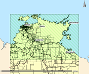
This polygon spatial dataset describes the benthic habitats likely to occur in marine environments around Gunn Point Peninsula and informs the desktop assessment of the marine biodiversity values for the region. The benthic habitats are inferred from existing information but in most cases require further data collection to validate and refine. Habitat modelling forms the basis of benthic community value assessment for Shoal Bay (Galaiduk et al. 2019). The accompanying report Marine and Coastal Biodiversity Assessment of the Gunn Point Area (2020) forms part of the Mapping the Future Project - Gunn Point. This project has identified land capability, water availability and biodiversity values to support land planning and inform development potential over the Gunn Point area. Reports and maps can be viewed from the webpage: denr.nt.gov.au/land-resource-management/development-opportunities - Development Potential of the Gunn Point Area (2020) - Biodiversity Assessment of the Gunn Point Area (2020) - Groundwater Resources of the Gunn Point Area (2020) - Marine and Coastal Biodiversity Assessment of the Gunn Point Area (2020) - Soil and Land Resources of the Gunn Point Area (2020) - Soil and Land Suitability Assessment for Irrigated Agriculture in the Gunn Point Area (2017) - Vegetation Communities of the Gunn Point Area (2020)
-
This spatial polygon dataset is derived from the 2001 mapping of mud crab (Scylla serrata) habitats along the NT and Queensland coastal wetlands. The polygons were derived from Landsat imagery and verified with field work and is suitable for use at scale 1:100,000. The information can be used in many ways to assist the management of these habitats. It provides a suitable baseline dataset for monitoring broad scale changes in area and composition of coastal wetland communities. Additionally, it provides information required by managers for choosing representative habitats for protection.